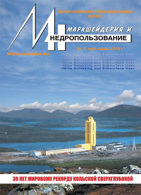
30 лет мировому рекорду Кольской сверхглубокой скважины
Топливно-энергетические ресурсы
Петрогеотермальные ресурсы как новый вид энергии XXI века
Petrogeothermal resources as a new type of energy for the 21st century
The authors provide preliminary economic appraisal of ratios of capital investment and the cost of energy and heat production by the new plants using the heat of the Earth's dry hot rocks at the depths up to 10 km achieved due to the innovative rapid well-boring technology. The authors demonstrate that the engineering and economical performance of these plants are not inferior to those of the modern power stations and boiler installations, while the new plants have a number of social and economical advantages.
Геология месторождений полезных ископаемых
Геологическое строение кровли третьего калийного пласта Старобинского месторождения
Geological structure of the formation top of the third potassium bed at Starobinskoe deposit
The author has established that the dynamical collapses of the roof upon the lower face space and face support have the highest probability in the range of depths between 570 and 725 m due to the presence of the heaviest V, VI sylvinite and carnallite layers in these sections.
Правовые проблемы недропользования
К вопросу об аренде участков недр
On land lease for resource exploration
According to the author, the lease of land plots for resource exploration shall only be possible after amending and supplementing the Russian Federation Law "On Underground Resources". The provisions governing the relations associated with the allocation of the land for resource exploration must take into account the specifics of leasing of such land plots. In this case the legal act adopted by the authorized executive authorities shall serve as the causal fact of origin of legal relations.
Техника и технология недропользования
Опытно-промышленные испытания анкерно-тросовой крепи
Commercial testing of the rope bolting support
The authors provide the results of the commercial tests of the new type of support for the roofs of development workings made in unstable argillaceous and saliferous materials - the rope bolting support designed and manufactured by closed JSC "Soligorsk Resource Saving Institute with Pilot Production". This type of support can be used in different geological and mining conditions of coal and saline deposits.
Геомеханика
Динамика оседаний земной поверхности в связи с горными ударами
The temporal dynamics of the land surface subsidence caused by mountain tremor
The author provides the basic results of the analysis of relationships between the measured subsidence of the observation stations on the land surface caused by mining-induced mountain tremor. The research had been conducted in the longwall mining areas under massif seismic activity conditions. The subsidence was estimated by means of geodetic measurements.
Анализ нарушений устойчивости откосов в районе выходов угольных пластов
Analysis of the slopes instability near the coal-bed bassets
As a result of the analysis of mining-geological and mine-engineering conditions of a coal bed development the authors have identified the mechanics of the opencast colliery edge deformation.
Ликвидация последствий оползня и разработка мероприятий по укреплению устойчивости борта карьера месторождения «Подотвальное»
Elimination of the consequences of the rock slide and development of the measures for increasing of the pit wall stability at «Podotvalnoye» deposit
The author provides the characteristics of the rock slide and proposes a number of measures aimed at increasing of the pit wall stability at «Podotvalnoye» deposit.
Определение механических свойств и состояния горных пород в натурных условиях
In-situ testing of the mechanical properties and states of rocks
The research carried out using the in-situ measurements method allowed to quickly assess the condition of the rock mass during the deposit preparation and development.
Погрешности расчета деформаций земной поверхности при производстве горных работ на больших глубинах угольных шахт Донбасса
Errors of calculation of the earth surface deformation during mining operations in deep coal mines of Donets basin
The errors of the calculated deformations characterize the entire specifics of the earth surface movements in conditions of a certain mine, for which the surveying station was built. These errors can be used when addressing the issues of underworking of industrial and civic buildings and structures on the surface, including railways, pipelines and natural objects.
Информационные технологии
Опыт применения скважинной видеометрии для изучения структуры массива скальных пород
The experience of using downhole videometry for the rock mass structure exploration
The authors describe the technique and provide the results of the videometering survey of the sample boreholes bored in the south-eastern pit wall at Kovdorsky GOK JSC. They come to the conclusion that downhole videometry is a very promising tool for exploring the rock mass structures.
Экология
Задачи и принципы моделирования динамики состояний эоловых геологических систем
The coals and principles of modelling the dynamics of the states of atmogenic geological systems
The author covers the goals and principles of modelling the dynamics of the states of atmogenic geological systems at three scale levels: interaction of individual particles of the soil, formation of the localized systems and territorial changes caused by the dynamics of individual subsystems of the territory.
История маркшейдерского дела
История становления и современное состояние маркшейдерского дела в отечественной и зарубежной нефтегазодобывающей промышленности
The history and the present state of mine surveying in domestic and foreign oil-and-gas industry
The author demonstrates the basic stages of creation and development of surveying support of oil and gas production. He describes the most important surveying operations in exploration of oil and gas deposits. With due regard to the specifics of hydrocarbon deposits exploration in Russia, he demonstrates the advisability for the resource users of possessing their own surveying divisions.


