


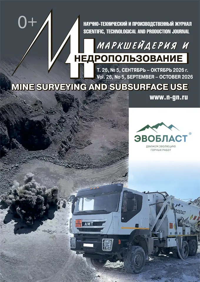
Controlled Blasting: A Discussion on Trends in the Mining Industry. An Interview with Dmitry Sizov
p. 5-8
- The Evoblast Group is a recognized leader in the field of advanced solutions for productive drilling and blasting operations. The company’s operations are rooted in principles of responsible business conduct, with a strong commitment to meeting safety requirements for its employees, clients, and the regions where its solutions are implemented. Our interviewee is Dmitry Sizov, a Business Development Manager at the Evoblast Group, who possesses deep insight into the factors that influence safety and efficiency, as well as the best practices for effectively promoting the company’s products and services.
Results of the International Conference "Innovative Processes Complex and deep Processing Natural and Non-Traditional Mineral Raw Materials" (Plaksin readings – 2026)
- The Scientific Council of the Russian Academy of Sciences on Mineral Processing, the Khabarovsk Federal Research Center of the Far Eastern Branch of the Russian Academy of Sciences (KFRC FEB RAS), and the N. V. Melnikov Research Institute of Comprehensive Exploitation of Mineral Resources of the Russian Academy of Sciences (IPKON RAS) held an international conference titled "Innovative Processes for the Comprehensive and Deep Processing of Natural and Non-conventional Mineral Raw Materials" (the 50th Plaksin Readings). The conference took place from September 21 to 26, 2026, in the city of Khabarovsk.
Natalya Alexandrovna Miletenko is 55 years old
- October 26, 2026, marks the 55th birthday of Natalia Alexandrovna Miletenko, a prominent scientist who has made significant contributions to the mining sciences through her work in geomechanics and the management of hydrogeomechanical processes. N. A. Miletenko’s research interests focus on ensuring the safety of mining operations in areas that affect water bodies, as well as environmental protection during the development of mineral resources.
Technology for increasing the oxidation potential of recycled solutions for uranium in-sit leaching
DOI: 10.56195/20793332-2026-26-5-16-21
 Ye. S. Oryngozhin1,2, R. A. Yusubaliev3, Ye. Ye. Oryngozha4, I. M. Malakhova5
- Institute of Mining after D. A. Kunaevа, Almaty, Republic of Kazakhstan
- Kazakh National University after Al-Farabi, Almaty, Republic of Kazakhstan
- National Engineering Academy of the Republic of Kazakhstan, Almaty, Republic of Kazakhstan
- 4Almaty University of Power Engineering and Telecommunications named after Gumarbek Daukeyev, Almaty, Republic of Kazakhstan
- 5Institute of Comprehensive Exploitation of Mineral Resources named after academician N. V. Melnikov Russian Academy of Sciences - IPKON RAS, Moscow, Russian Federation
- Abstract:
- This article presents theoretical studies of the physicochemical mechanisms of leaching processes related to the oxidation-reduction conditions of the environment, the ability of elements to form compounds with other elements, form ions of varying valence, yield soluble or gaseous compounds. The Semizbay deposit's ores are visually indistinguishable from the host rocks and are distinguished only by sampling. Uranium is found in these ores in both mineral and sorbed forms. The ores are primarily loose and poorly cemented; carbonate ores make up 20% of the deposit's ores and are the primary acid absorbers during sulfuric acid leaching. The ionic composition of the uranium leaching solution during the acidification stage of the formations was analyzed, and the interaction of sulfuric acid solutions with the ore-hosting rocks was assessed.
- Keywords:
- research, regularity, in-situ leaching, physicochemical processes, oxidation potential, elements, compounds, uranium
- For citation:
- Oryngozhin Ye., Yusubaliev R., Oryngozha Ye., Malakhova I.M. Technology for increasing the oxidation potential of recycled solutions for uranium in-sit leaching. Mine Surveying and Subsurface Use. 2026; 26 (5): 16-21. https://doi. org/10.56195/20793332-2026-26-5-16-21
Laser scanning technologies in the complex of mine surveying support for open-pit mining at a gold deposit
DOI: 10.56195/20793332-2026-26-5-22-29
К. Yu. Мoskalenko
- T. F. Gorbachev Kuzbass State Technical University, Kemerovo, Russian Federation
- Abstract:
- The article presents the results of research describing the main production parameters and mining systems applied at the "K" gold deposit. The mining and technical conditions, topography, and geological structure of the site are established, along with the technology for open-pit mining in harsh climatic conditions. The methodology for surveying the actual position of mine workings using various laser scanning systems - terrestrial (RIEGL VZ-4000), aerial (DJI Matrice 350 RTK) and mobile (GoSLAM) - is described. In accordance with the technological cycle, methods for mine surveying support of drilling and blasting operations are detailed, including high-precision GNSS positioning of drilling rigs and the surveying department's protocols for technical failures of navigation systems. The technology for monitoring muck pile parameters using displacement sensors and laser scanning systems is considered. The research results can be applied to the selection and further implementation of laser scanning systems into the operational cycle of open-pit mining to improve the accuracy of mine survey production accounting, as well as to minimize mineral losses in deposits with complex ore body morphology.
- Keywords:
- gold deposit, mine surveying support, laser scanning, UAV, drilling and blasting operations, GNSS monitoring, openpit mining, KuzSTU
- For citation:
- Мoskalenko К.Yu. Laser scanning technologies in the complex of mine surveying support for open-pit mining at a gold deposit. Mine Surveying and Subsurface Use. 2026; 26 (5): 22-29. (In Russ.). https://doi.org/10.56195/20793332-2026-265-22-29
Development of an algorithm for modeling mineral deposits based on a spatial Мarkov chain with a fixed path
DOI: 10.56195/20793332-2026-26-5-30-35
А. А. Basargin1,2
- Federal State Budgetary Institution of Science “Institute for Problems of Comprehensive Development of Subsoil Academician N.V. Melnikov” of the Russian Academy of Sciences, Moscow, Russian Federation
- Federal State Budgetary Institution of Higher Education “Siberian State University of Geosystems and Technologies”, Novosibirsk, Russian Federation
- Abstract:
- The article presents the results of developing an algorithm for modeling mineral deposits based on a spatial Markov chain with a fixed path and incorporating interclass dependencies. An analysis of Markov chain random field modeling methods for creating transiograms that allow for the reproduction of the spatial structure of a mineral deposit is presented. An approach for using transiograms in modeling the large-scale structure of a mineral deposit and for spatiotemporal uncertainty analysis of discrete spatial variables is substantiated. An algorithm for modeling mineral deposits for the efficient determination of cause-and-effect relationships and spatial patterns in the qualitative and quantitative parameters of a deposit is described in detail. One of the advantages of this approach is that the modeled transiograms tend to follow experimental data. The research results can be useful in determining the spatial characteristics of a mineral deposit.
- Keywords:
- transiograms, Markov chains, cokriging, topology label matrix, stochastic modeling
- For citation:
- Basargin А.А. Development of an algorithm for modeling mineral deposits based on a spatial Мarkov chain with a fixed path. Mine Surveying and Subsurface Use. 2026; 26 (5): 30-35. (In Russ.). https://doi.org/10.56195/20793332-2026-26-5-30-35
Determination of advance sampling grid parameters for coal quality control in a complex-structure seam
DOI: 10.56195/20793332-2026-26-5-36-42
E.A. Tagaev
- National University of Science and Technology MISIS, Moscow, Russian Federation
- Abstract:
- The paper proposes a methodological approach to determining the parameters of an advance coal sampling grid for a complex-structured seam based on quality indicator modelling. The approach is motivated by the fact that seam-average quality estimates do not reliably predict local intervals that deteriorate the quality of mined coal in seams of complex structure. The methodology was tested for seam H16 of the Northwestern block of the Elga deposit, where the 3rd mineralized pack was treated as an independent geological-technological object. The calculation sample included 115 boreholes, and the Ad100% index accounting for full contamination by intra-seam rock partings was calculated for each borehole. Ad100% ranges from 23.0 to 60.2 %, with an average of 35.0 % and a coefficient of variation of 17.5 %. The procedure included statistical analysis, construction of the experimental variogram, comparison of spherical, Gaussian, exponential and linear models, ordinary kriging, and analysis of the kriging variance map. It was found that the spatial correlation of Ad100% is weak and unstable: the variogram nearly reaches the sill already at the first lag and then fluctuates around it. The kriged contour map of Ad100% and the kriging variance map show that the adequacy of the advance sampling grid should be assessed not only by mean spacing, but also by the grid configuration, local quality heterogeneity and observation density. The proposed approach can be used to compare 14 × 14 m and 20 × 20 m operational grids and to delineate areas where local densification of advance sampling is required.
- Keywords:
- advance sampling, complex-structured seam, ash content, Ad100%, sieve-float analysis, variogram, kriging, kriging variance, sampling grid
- For citation:
- Tagaev E.A. Determination of advance sampling grid parameters for coal quality control in a complex-structure seam. Mine Surveying and Subsurface Use. 2026; 26 (5): 36-42. (In Russ.). https://doi.org/10.56195/20793332-2026-26-5-36-42
Comparative analysis of the stability of rock mass volume calculation methods under varying point-cloud density
DOI: 10.56195/20793332-2026-26-5-43-49
M.G. Vystrchil1, M.V. Romanov2, L.A. Ramirez-Melendez1
- Empress Catherine II Saint Petersburg Mining University, Saint-Petersburg, Russian Federation
- JSC "Artyomovsky Mine", Krasnoyarsk, Russian Federation
- Abstract:
- The paper presents a comparative analysis of the stability of rock mass volume estimation methods under varying point-cloud density in open-pit mining conditions. The initial spatial data were obtained from UAV photogrammetry and processed in Agisoft Metashape to generate a dense point cloud, a digital surface model, and an orthomosaic. To evaluate the influence of spatial data density, the original point cloud was progressively decimated by increasing the spacing between neighbouring points. Volume calculations were performed using three approaches: TIN-based modelling in AutoCAD Civil 3D, digital surface difference analysis in a GIS environment, and voxel-based modelling. For each spatial-data configuration, absolute deviations and relative errors of volume estimation were determined with respect to the reference configuration corresponding to the maximum point-cloud density. The results show that for point spacings up to 10 m, the relative errors of both CAD- and GIS-based approaches remain within the allowable limit of σallow=1%. However, further increase in spacing leads to accelerated error growth in the GIS environment. The study demonstrates that TIN-based modelling exhibits higher stability under reduced spatial-data density, whereas the voxel-based approach provides comparatively stable results for local-scale analysis. The obtained results can be applied for selecting appropriate spatial-modelling algorithms and processing parameters for UAV- and LiDAR-based mine surveying in open-pit mining operations.
- Keywords:
- point cloud, UAV photogrammetry, volume estimation, open-pit mining, TIN modelling, GIS, voxel modelling, spatial data
- For citation:
- Vystrchil M.G., Romanov M.V., Ramirez-Melendez L.A. Comparative analysis of the stability of rock mass volume calculation methods under varying point-cloud density. Mine Surveying and Subsurface Use. 2026; 26 (5): 43-49. (In Russ.). https:// doi.org/10.56195/20793332-2026-26-5-43-49
DOI: 10.56195/20793332-2026-26-5-50-55
A. R. Tukhbatulin1, Yu. A. Vasyanovich1, P. S. Taran2
- Federal State Autonomous Educational Institution of Higher Education “Vladivostok State University”, Vladivostok, Russian Federation
- Yakutskaya Vzryvnaya Kompaniya LLC (Yakut Explosive Company), Spassk-Dalny, Russian Federation
- Abstract:
- The article addresses the problem of charging water-filled boreholes with cartridged emulsion explosives in conditions where the use of mixing-charging machines is impossible or economically impractical. The traditional manual charging method often leads to disruption of the charge column integrity, formation of water interlayers, and sticking of cartridges. To solve these problems, a new device for forming the charge column is proposed. The method allows controlled lowering of the cartridge into the borehole, avoiding water hammer during the transition from the air environment to the water environment, and prevents sticking and the formation of water interlayers. The developed technical solution is recommended for industrial application in open-pit mining operations under complex hydrogeological conditions. The article also outlines directions for further research: evaluating effectiveness in boreholes of other diameters, increasing the sample size, direct measurements of detonation velocity, and analysis of oversized fragment yield.
- Keywords:
- open-pit mining, drilling and blasting operations; water-filled boreholes; cartridged emulsion explosives; manual charging; charge forming device; charge column integrity
- For citation:
- Tukhbatuli A.R., Vasyanovich Yu.A., Taran P.S. Method of forming a borehole charge with cartridged emulsion explosive in flooded boreholes at construction material quarries in Primorsky krai. Mine Surveying and Subsurface Use. 2026; 26 (5): 50-55. (In Russ.). https://doi.org/10.56195/20793332-2026-26-5-50-55
Drilling and blasting of large-section mining workings in permafrost conditions by the solid failing method
DOI: 10.56195/20793332-2026-26-5-56-64
V. F. Gutnik1, A. N. Anushenkov2
- JSC Mosproekt-3, Moscow, Russian Federation
- Institute of Non-Ferrous Metals, Siberian Federal University, Krasnoyarsk, Russian Federation
- Abstract:
- Transport infrastructure is currently being actively developed in remote regions of the Russian Federation, specifically increasing the capacity of the Trans-Siberian and Baikal-Amur Mainlines. To address this challenge, new tunnels must be constructed. Drilling and blasting have been and remain one of the primary methods for excavating mine workings, and the method of excavation is crucial and determines the key technical and economic indicators of a project. Compared to the bench method, continuous stoping (full-section tunneling) allows for increased speed by reducing the number of key operations in the work cycle, ultimately bringing the working to its design cross-section. Furthermore, full-section tunneling allows for parallel construction of a permanent lining at some distance from the working face. These factors reduce construction time and, consequently, the overall project cost. One of the key factors determining the quantitative and cost metrics for reducing construction time and costs is increasing the face length per drilling and blasting cycle. Increasing the length of the developed face is challenging, as it typically reduces blast efficiency, resulting in a decrease in blasthole utilization. This article presents and describes in detail an innovative cutting scheme and drilling and blasting protocols that enable efficient development of large-diameter mine workings using continuous face mining in permafrost conditions. It also presents a methodology for its development, based on modeling and experimental testing of various variations of the modeled schemes during the construction of a railway tunnel running through permafrost.
- Keywords:
- driving, tunnel, continuous face method, permafrost, blasting pattern, utilization factor of blasthole, borehole, cut
- For citation:
- Gutnik V.F., Anushenkov A.N. Drilling and blasting of large-section mining workings in permafrost conditions by the solid failing method. Mine Surveying and Subsurface Use. 2026; 26 (5): 56-64. (In Russ.). https://doi.org/10.56195/20793332-202626-5-56-64
The current state and prospects of organizing the use of artificial intelligencein mining safety issues
DOI: 10.56195/20793332-2026-26-5-65-73
V.A. Atrushkevich, S.M. Popov
- Institute of Comprehensive Exploitation of Mineral Resources Russian Academy of Sciences, Moscow, Russian Federation
- Abstract:
- The article examines the current state and prospects for organizing the use of artificial intelligence (AI) in ensuring the safety of mining operations. The relevance of the study is due to the high level of production risks in the mining industry and the need to improve the efficiency of industrial safety systems in the context of digital transformation. An analysis has been carried out of the theoretical foundations of AI development, the specifics of ensuring the safety of mining operations, and the role of intelligent technologies in managing production risks. Modern practices of AI implementation at Russian and foreign mining enterprises are considered, including predictive analytics, computer vision, digital twins, and decision support systems. The main problems and limitations of AI application have been identified, such as insufficient digital infrastructure, a shortage of personnel, the high cost of implementation, and issues related to regulatory and legal regulation. Promising directions for the development of AI in the mining industry have been substantiated, including the creation of autonomous systems, the development of digital ecosystems, and the improvement of the organizational mechanism for implementation. Recommendations have been developed to enhance the effectiveness of AI application in the industrial safety system.
- Keywords:
- artificial intelligence; mining industry; industrial safety; digitalization; predictive analytics; computer vision; digital twin; risk management; production automation; intelligent systems
- For citation:
- Atrushkevich V.A., Popov S.M. The current state and prospects of organizing the use of artificial intelligence in mining safety issues. Mine Surveying and Subsurface Use. 2026; 26 (5): 65-73. (In Russ.). https://doi.org/10.56195/20793332-202626-5-65-73
Radon flux density at the Anavgay geothermal, Kamchatka Territory
DOI: 10.56195/20793332-2026-26-5-74-83
V.A. Kudryashov
- FGBUN Research Geotechnological Center, Far Eastern Branch of Russian Academy of Sciences, Petropavlovsk-Kamchatsky, Russian Federation
- Abstract:
- Radon has both negative and beneficial effects on the human body, so the density of radon fluxes from the depths of the Earth requires detailed study. Determining the flux density makes it possible to assess the potential radon hazard in buildings, and also helps to carry out geological exploration for natural radioactive elements (NRE) – uranium, thorium, radium. The Kamchatka Peninsula as a whole belongs to the territories with a low content of NRE, however, there are local places where radon emissions are significant. These are some geothermal manifestations, high-temperature fumaroles, hydrothermal vents, and volcanoes. One of these places is the Anavar geothermal deposit, (located almost in the center of the Kamchatka Peninsula in the foothills of the Sredinny ridge Fig.1a), in the associated gases of which radon was discovered not so long ago. To assess the environmental impact, the task was set to determine the intake of radon fluxes by the area of a geothermal deposit (radon flux density-RFD). There is the village of Anavgay located on the territory of the deposit, the public and residential buildings of which are heated by geothermal water, and therefore, the distribution of radon affects the environmental situation. The purpose of the work was to preliminarily determine the radon flux density (RFD) in the field and to assess the relationship with geological ruptures and man-made disturbances (wells). Field research was conducted in 2025-2026. RFD was determined using the quasi-integral method of the NITON Scientific and Technological Center using the "Camera-01" measuring complex for radon monitoring. A total of 14 measuring chambers were installed at the field. The measurements showed relatively insignificant radon flux densities over the deposit area, averaging 11 ± 5.1 MBq/m2s. A significant unevenness in the distribution of the radon flux density over the field area from zero to 35 ± 7 MBq/m2s (near the liquidated well No. E-3) was noted. It was found out that the zones of increased RFD values are not directly related to the corresponding zones of tectonic disturbances, which is probably due to the dispersion of flows by modern deposits on the surface of the deposit, which are screens for radon penetration from the depths, or dissipate the flow. To a greater extent, the increased RFD values are confined to wells where the volume activity of radon measured in tens of thousands of Becquerels is determined in associated gases.
- Keywords:
- Kamchatka Territory, Sredinny ridge, Anavgay geothermal deposit, radon, wells, radon flux density
- For citation:
- Kudryashov V.A. Radon flux density at the Anavgay geothermal, Kamchatka Territory Mine Surveying and Subsurface Use. 2026; 26 (5): 74-83. (In Russ.). https://doi.org/10.56195/20793332-2026-26-5-74-83
Integration of Fourier analysis and neural network models for assessing hydrometeorological hazards in the North Caucasus federal district
DOI: 10.56195/20793332-2026-26-5-84-89
A. I. Lazovsky
- Federal State Budgetary Educational Institution of Additional Professional Education "Institute of Advanced Training for Managers and Specialists", Balashikha, Russian Federation
- Abstract:
- The article presents a comprehensive analysis of the sustainability of ecosystems in the North Caucasus region to anthropogenic stress in the context of increasing anthropogenic impact. The relevance of the study is due to the high natural vulnerability of the territory, which is associated with its complex orographic structure, climatic heterogeneity, and intensive economic development. The study is based on the integration of remote sensing data, geoinformation modeling methods, and statistical analysis of environmental monitoring data from Rosgidromet, Rosprirodnadzor, and regional environmental protection agencies for the period 2018–2024. The use of an interdisciplinary approach made it possible to identify the spatial and temporal patterns of the transformation of natural complexes and to assess the level of their resistance to anthropogenic impact. The natural-geographical, geochemical, and climatic features of the North Caucasus, which determine the specifics of the formation of environmental risks, are considered. It has been established that the main factors of ecosystem degradation are mining activities, intensive agriculture, and urbanization processes. As a result of anthropogenic impact, processes of soil erosion and degradation, contamination of surface and groundwater, reduction of biodiversity, and changes in river hydrological regimes are observed. The analysis of geoinformation models and satellite data has shown that a significant part of the region is characterized by a reduced level of ecological stability, with mountainous and foothill areas being the most vulnerable. The scientific novelty of the study lies in the integrated assessment of ecosystem stability based on the combination of heterogeneous data and spatial analysis methods. Based on the obtained results, measures are proposed to improve geoecological monitoring systems, implement environmentally safe technologies, and rehabilitate disturbed lands. The implementation of a comprehensive approach to environmental management will reduce technogenic load and ensure sustainable development of the North Caucasus region.
- Keywords:
- North Caucasus region, hydrometeorological threats, Fourier transform, neural networks, time series, forecasting
- For citation:
- Lazovsky A.I. Integration of Fourier analysis and neural network models for assessing hydrometeorological hazards in THE North Caucasus federal district. Mine Surveying and Subsurface Use. 2026; 26 (5): 84-89. (In Russ.). https://doi. org/10.56195/20793332-2026-26-5-84-89
Features of environmental impact forecasting in designing an environmentally sustainable mining system
DOI: 10.56195/20793332-2026-26-5-90-97
N.V. Gonchar1, S.V. Kornilkov2, I.A. Chetverkin3, V.A. Pikalov4
- Russian Copper Company JSC, Ekaterinburg, Russian Federation
- Institute of Mining, Ural Branch, Russian Academy of Sciences, Ekaterinburg, Russian Federation
- "Monitoring of Mineral Deposits" Research and Production Firm LLC, Ekaterinburg, Russian Federation
- "Scientific and Technical Center – Geotechnology" LLC, Chelyabinsk, Russian Federation
- Abstract:
- The paper presents the structure and sequence of geological-structural and hydrogeological modeling to forecast hydrogeological and geomechanical consequences when using tailings for the liquidation of mine workings. An approach to creating coupled geological-structural, geomechanical, hydrogeological, and hydrochemical models is described. The practical significance of the research is demonstrated by the example of the integrated mining system "Tominsky GOK – Korkinsky Coal Mine", where the use of tailings to backfill the mined-out space of the open-pit coal mine achieved zero wastewater discharge, eliminated endogenous fires, and ensured long-term environmental rehabilitation of the area.
- Keywords:
- mining system, environmental safety, project life cycle, geological-structural modeling, hydrogeological forecasting, water balance, implicit modeling, anthropogenic georesources, backfilling of mined-out space
- For citation:
- Gonchar N.V., Kornilkov S.V., Chetverkin I.A., Pikalov V.A. Features of environmental impact forecasting in designing an environmentally sustainable mining system. Mine Surveying and Subsurface Use. 2026; 26 (5): 90-97. (In Russ.). https://doi. org/10.56195/20793332-2026-26-5-90-97
Integrated methodology for studying fault-block tectonics and its influence on petroleum potential
DOI: 10.56195/20793332-2026-26-5-98-104
M.V. Andreev1, V.P. Petrishchev1,2, G. A. Ponomareva1
- Federal State Budgetary Educational Institution of Higher Education “Orenburg State University named after V. A. Bondarenko”, Orenburg, Russian Federation
- Federal State Budgetary Institution of Science Orenburg Federal Research Center of the Ural Branch of the Russian Academy of Sciences, Orenburg, Russian Federation
- Abstract:
- The article considers an integrated approach to the study of fault-block tectonics and its influence on petroleum potential in platform sedimentary basins, using the Southern Pre-Urals as an example. The approach combines 2D/3D CDP seismic data, seismic attributes, gravity and magnetic data, remote sensing, geodynamic monitoring, well logging, core and production data. The proposed workflow includes mapping buried faults, refining the basement structure, assessing the stress-strain state and verifying predicted fractured zones using drilling and production information. Special attention is paid to near-fault fractured zones as a factor controlling reservoirs with improved reservoir properties. Quantitative efficiency indicators are treated as calculation and interpretation estimates that require additional calibration using production data. The practical significance of the approach consists in improving the justification of fractured reservoir prediction and fault representation in geological and hydrodynamic models. The results can be used to select areas for detailed study, substantiate the placement of exploration, appraisal and production wells, and refine geological and hydrodynamic reservoir models.
- Keywords:
- fault-block tectonics, fractured reservoirs, geodynamic modelling, seismic attribute analysis, geodynamic monitoring, petroleum potential prediction, Southern Pre-Urals, geological and geophysical data integration, near-fault zones, reservoir properties
- For citation:
- Andreev M.V., Petrishchev V.P., Ponomareva G.A. Integrated methodology for studying fault-block tectonics and its influence on petroleum potential. Mine Surveying and Subsurface Use. 2026; 26 (5): 98-104. (In Russ.). https://doi. org/10.56195/20793332-2026-26-5-98-104
Geological and geodynamic conditions for the formation of hydrocarbon deposits in the Southern Pre-Urals
DOI: 10.56195/20793332-2026-26-5-105-112
M.V. Andreev1, V.P. Petrishchev1,2, G.A. Ponomareva1
- Federal State Budgetary Educational Institution of Higher Education "Orenburg State University named after V.A. Bondarenko", Orenburg, Russian Federation
- Federal State Budgetary Institution of Science Orenburg Federal Research Center of the Ural Branch of the Russian Academy of Sciences, Orenburg, Russian Federation
- Abstract:
- The geological and geodynamic conditions for the formation of hydrocarbon deposits in the Southern Pre-Urals are examined. A comprehensive analysis was carried out of the deep structure of the Earth’s crust and the fault-block tectonics of the crystalline basement, which comprises rocks of Precambrian and Baikalian ages and is divided by a system of regional faults into blocks of different orders. Interpretation of gravity and magnetic data and seismic surveys refined the positions of the main fault zones (the Tokovsky and Sakmara-Ilek faults and a system of submeridional faults), which control the inherited development of the sedimentary cover. The structure of the sedimentary cover was investigated; it comprises three structural and lithological complexes (subsalt, intersalt, and suprasalt), whose thicknesses systematically increase from west to east from 2–3 to 10–12 km. An inherited relationship between the block structure of the basement and the formation of local uplifts in the sedimentary cover is demonstrated. Analysis of the spatial distribution of known fields in the Bolshekinelskaya and Kamelik-Chaganskaya zones established their clear association with zones influenced by deep faults and with fault intersections. The decisive role of near-fault fracture zones in forming reservoirs with improved permeability and storage properties and in creating various types of hydrocarbon traps is substantiated. Seismic monitoring and satellite geodesy (GPS/GNSS) data indicate present-day geodynamic activity in the region (movement rates of 2–4 mm/year and seismicity of Mw = 1.5–3.0), which directly affects fluid redistribution and field development parameters. A generalized model of the control of hydrocarbon accumulation by fault-block tectonics is proposed, incorporating the framework function of faults, their control of sedimentation and lithogenesis, the creation of hydrocarbon migration pathways, and trap formation. Practical application of the model will improve the effectiveness of predicting and exploring local targets controlled by tectonic faults, particularly at advanced stages of regional exploration.
- Keywords:
- fault-block tectonics, Southern Pre-Urals, geodynamics, near-fault fracturing, fractured reservoirs, seismicity, hydrocarbon accumulation, basement, sedimentary cover, Orenburg oil-gas-condensate field
- For citation:
- Andreev M.V., Petrishchev V.P., Ponomareva G.A Geological and geodynamic conditions for the formation of hydrocarbon deposits in the Southern Pre-Urals. Mine Surveying and Subsurface Use. 2026; 26 (5): 105-112. (In Russ.). https://doi. org/10.56195/20793332-2026-26-5-105-112
Composite typing of geometric structures of a three-dimensional geochemical field in a porphyry copper system
DOI: 10.56195/20793332-2026-26-5-113-117
I.O. Panichkin
- National University of Science and Technology MISIS, Mining Institute, Moscow, Russian Federation
- Abstract:
- This study proposes a method for composite typing of geometric structures within the three-dimensional geochemical field of a porphyry copper system. The method is intended to divide an ore field into high-potential, transitional and low-potential mininggeological types while accounting not only for copper grade but also for the local shape of the geochemical field, spatial anisotropy, position relative to the ore core and peripheral halos, and lithological domain. The workflow combines geochemical indices, local quadratic field approximation, Hessian analysis and an estimate of linear anisotropy into a composite interval-scale ore-potential indicator. Validation was performed using measured copper grades, geological domains and two independent scenarios for defining mineralized intervals. Types 110 and 120 showed the most stable relationship with copper mineralization: 75.2 % of their interval length has copper grades not lower than 0.30 %, while their length-weighted grades are 0.706 % and 0.698 %, respectively. The high-potential group covers 43.1 % of mineralized intervals under the Russian State Commission on Mineral Reserves criterion scheme and 49.0 % under the Canadian-style scenario; inclusion of transitional types increases coverage to 81.9 % and 94.0 %. The novelty of the approach is the integration of geochemical intensity, local field geometry and anisotropy within a single interpretable classification framework. The method can support ore-body detailing, selection of prospective areas, planning of follow-up exploration, and subsequent mine planning while preserving geological interpretability at the interval scale. The research results may be useful for the integrated interpretation of sampling data, spatial zoning of the ore field, assessment of its internal heterogeneity, and selection of areas requiring additional geological detailing.
- Keywords:
- porphyry copper system, three-dimensional geochemical field, Hessian analysis, spatial anisotropy, composite typing, copper grade, geological domains, mineralized intervals, ore potential, mine planning
- For citation:
- Panichkin I.O. Composite typing of geometric structures of a three-dimensional geochemical field in a porphyry copper system. Mine Surveying and Subsurface Use. 2026; 26 (5): 113-117. (In Russ.). https://doi.org/10.56195/20793332-2026-265-113-117
Increasing of a blasted block width in the open pit final-wall zone by using relief pauses with keeping safety vibration
DOI: 10.56195/20793332-2026-26-5-118-124
I.O. Kovalchuk, А.А. Dobrynin, R.A. Rakhmanov
- Institute of comprehensive exploration of mineral resources Russian academy of sciences, Moscow, Russian Federation
- Abstract:
- This paper presents the results of measurements of blast-induced ground vibration from a production blast in the finalwall zone of an open pit, including an analysis of the effect of the blasted block width on the amplitude of peak particle velocity in the rock mass. The paper also evaluates the loss of excavation productivity as a function of the width of blasted blocks and proposes measures that generally contribute to improving pit slope stability and increasing the productivity of loading and hauling equipment. The paper is based on a description of a blasting technique involving the use of relief pauses in combination with an electronic initiation system. A combined application of electronic and non-electric initiation systems is also considered. In addition, the paper emphasizes the importance of highly qualified technical support during the implementation of electronic initiation systems, taking into account the geological and structural conditions of the rock mass. Research results can be useful to prepare for excavation rock mass by drilling and blasting method in the conditions of deep open pits where issues of seismic safety are priority.
- Keywords:
- ground vibration, overbreak, peak particle velocity, geological and structural conditions, vibration sensors, in-hole geophone, regression analysis, excavation and loading equipment productivity, pit slope stability, electronic blasting system, relief pauses
- For citation:
- Kovalchuk I.O., Dobrynin А.А., Rakhmanov R.A. Increasing of a blasted block width in the open pit final-wall zone by using relief pauses with keeping safety vibration. Mine Surveying and Subsurface Use. 2026; 26 (5): 118-124. (In Russ.). https:// doi.org/10.56195/20793332-2026-26-5-118-124
Characteristics of methane emission from a coal seam being mined in zones of geological discontinuities
DOI: 10.56195/20793332-2026-26-5-125-129
E.V. Fedorov, S.B. Kulibaba, N.A. Miletenko
- N. V. Melnikov Research Institute of Comprehensive Exploitation of Mineral Resources of the Russian Academy of Sciences (IPKON RAS), Moscow, Russian Federation
- Abstract:
- Actual operational data from a longwall mining system were investigated regarding the intersection of fault-type geological discontinuities in the coal seam and the performance of preliminary in-seam degasification boreholes within these zones. Based on an analysis of this data, the study established the patterns of change in methane emission rates into the working area, downtime required for face ventilation, and gas yield parameters from the seam into degasification boreholes, depending on the boreholes' positioning relative to the zones of geological discontinuities.
- Keywords:
- fault-type geological discontinuities, hazard zone, methane emission, methane flow rate, preliminary in-seam degasification
- For citation:
- Fedorov E.V., Kulibaba S.B., Miletenko N.A. Characteristics of methane emission from a coal seam being mined in zones of geological discontinuities. Mine Surveying and Subsurface Use. 2026; 26 (5): 125-129. (In Russ.). https://doi. org/10.56195/20793332-2026-26-5-125-129
Relationships of iron and sulfur content with gas content and heterogeneity of microstructure of coals
DOI: 10.56195/20793332-2026-26-5-130-135
I.N. Gorshenkov, B.N. Pashichev, E.V. Ulyanova
- Melnikov Institute of Comprehensive Exploitation of Mineral Resources, Russian Academy of Sciences, Moscow, Russian Federation
- Abstract:
- The safety of underground mining of methane-bearing coal seams is largely determined by the gas-kinetic state of the rock mass. Studies show that methane content and methane-emission intensity may vary substantially within the same coal seam even under similar geological conditions of its formation. This indicates the need to consider the properties of coal associated with its gas content, its ability to retain methane, and the natural release of methane. The aim of the study is to identify the relationships of the contents of iron (Fe), sulfur (S), and pyrite (FeS2), as well as the relative balance of iron- and sulfur-bearing components (Fe/S), with the components of total gas content and the microstructural organization of coal. The contents of Fe and S were determined by X-ray fluorescence analysis. The components of total gas content Q1, Q2, Q3, and QΣ were determined using the method developed at ICEMR RAS, while the mean values of information entropy H̄ and statistical complexity C̄ were calculated from series of SEM images. Positive relationships were found between the contents of iron, sulfur, and pyrite and Q1, Q2, Q3, and total gas content QΣ. As Fe/S increased, mean entropy decreased and mean statistical complexity increased; the directions of the relationships remained unchanged when individual observations were sequentially excluded. The relationships obtained may be used when comparing different sections of a coal seam to control methane emissions and substantiate ventilation and degassing measures. The results are consistent with the hypothesis that iron-bearing minerals may participate in methane formation but do not prove a specific mechanism of its formation.
- Keywords:
- coal seam, methane content, gas emission, iron, sulfur, pyrite, X-ray fluorescence analysis, coal microstructure, information entropy, statistical complexity
- For citation:
- Gorshenkov I.N., Pashichev B.N., Ulyanova E.V. Relationships of iron and sulfur content with gas content and heterogeneity of microstructure of coals. Mine Surveying and Subsurface Use. 2026; 26 (5): 130-135. (In Russ.). https://doi. org/10.56195/20793332-2026-26-5-130-135